Guide to the Climb Profiles
Each climb has its own profile, designed to show the different gradients.
On this page you can find out more about how to read the profiles, as well as how the data is collected for them.
We will also talk about the limitations of the profiles; including issues regarding the accuracy, as well as how they can hide certain difficulties at times.
i) The gradients are given for each kilometre throughout the climb. The colours also represent a specific range to enable you to see the difficulty of a climb at a glance:
ii) Where there are unusually steep sections on a climb, we have added a line indicating the specific gradient. These sections are at least 100m long and are where it is unusually steep. This, for example, may include a 10% section during a kilometre that averages 2% gradient. However, we wouldn't indicate, for example, a 12% section during a kilometre that averages 10% - as this kind of variance is normal on climbs (which are very rarely a perfectly steady gradient).
iii) On the top left and the top right of the profile you will find the nearest town or village to the start and the finish of the climb. If the climb starts or finishes some way from the town you will see an arrow next to the town name. For more details on the exact location you can scroll down and read the full profile description.
iv) Each profile can be clicked to open in a new window - this is particularly useful for longer climbs, where it can be difficult to read the information without enlarging the image.
The starting point of the climb is decided somewhat arbitrarily, but is basically where it feels as though the climbing has started. For example, a long 10km drag of around 2% gradient would not usually be included in a profile if it comes at the beginning of a climb.
i) The profiles do not automatically show significant variations within a kilometre. For example, the profile may show a kilometre that averages a 5% gradient, but half of that could be at 10% and half at 0% - making it a tougher climb.
ii) The exact numbers are not guaranteed, so should not be used for any official research purposes or other documentation. They are based on readings from a barometric altimeter, which generally has good accuracy, but can be affected to a small degree by external factors. Although the extct altitude may not always be correct to the metre, the gradients for each kilometre carry a higher degree of accuracy and our testing has found them to be reliable.
iii) The profiles are copyrighted and can not be reproduced without permission. If you would like to use the profiles on your website, please contact us with a brief description of what you would like to use them for.
Ultimately the profiles are for information purposes and are best used in conjunction with the written information on each page. They don't always tell the whole story, but they do often provide a rough guide to a climb that can be easily seen at a glance.
We will also talk about the limitations of the profiles; including issues regarding the accuracy, as well as how they can hide certain difficulties at times.

How do I use the profiles?
Above you can see an image of a standard climb profile, and within this there are several things which can be useful for a touring cyclist:i) The gradients are given for each kilometre throughout the climb. The colours also represent a specific range to enable you to see the difficulty of a climb at a glance:
Grey: less than 0% (i.e. a downhill section)
Green: 0% - 3.9%
Blue: 4% - 5.9%
Yellow: 6% - 7.9%
Orange: 8% - 9.9%
Red: 10% - 14.9%
Black: 15%+ (thankfully very rare!)
Green: 0% - 3.9%
Blue: 4% - 5.9%
Yellow: 6% - 7.9%
Orange: 8% - 9.9%
Red: 10% - 14.9%
Black: 15%+ (thankfully very rare!)
ii) Where there are unusually steep sections on a climb, we have added a line indicating the specific gradient. These sections are at least 100m long and are where it is unusually steep. This, for example, may include a 10% section during a kilometre that averages 2% gradient. However, we wouldn't indicate, for example, a 12% section during a kilometre that averages 10% - as this kind of variance is normal on climbs (which are very rarely a perfectly steady gradient).
iii) On the top left and the top right of the profile you will find the nearest town or village to the start and the finish of the climb. If the climb starts or finishes some way from the town you will see an arrow next to the town name. For more details on the exact location you can scroll down and read the full profile description.
iv) Each profile can be clicked to open in a new window - this is particularly useful for longer climbs, where it can be difficult to read the information without enlarging the image.
How is the data collected for the profiles?
The data is collected manually (i.e by actually cycling the climbs) using a barometric altimeter which is calibrated to a known altitude at the beginning of each climb. This is much more accurate and consistent than most cycling profiles that you will see, which use satellite data.The starting point of the climb is decided somewhat arbitrarily, but is basically where it feels as though the climbing has started. For example, a long 10km drag of around 2% gradient would not usually be included in a profile if it comes at the beginning of a climb.

What are the limitations of the profiles?
The profiles are quite accurate and provide a good representation of what you can expect on a climb; however, there are a few limitations that it is worth bearing in mind:i) The profiles do not automatically show significant variations within a kilometre. For example, the profile may show a kilometre that averages a 5% gradient, but half of that could be at 10% and half at 0% - making it a tougher climb.
ii) The exact numbers are not guaranteed, so should not be used for any official research purposes or other documentation. They are based on readings from a barometric altimeter, which generally has good accuracy, but can be affected to a small degree by external factors. Although the extct altitude may not always be correct to the metre, the gradients for each kilometre carry a higher degree of accuracy and our testing has found them to be reliable.
iii) The profiles are copyrighted and can not be reproduced without permission. If you would like to use the profiles on your website, please contact us with a brief description of what you would like to use them for.
Ultimately the profiles are for information purposes and are best used in conjunction with the written information on each page. They don't always tell the whole story, but they do often provide a rough guide to a climb that can be easily seen at a glance.
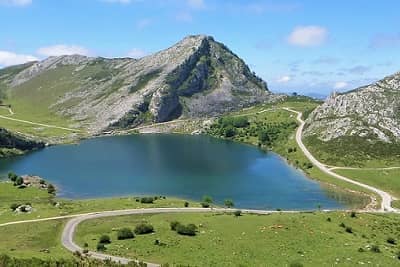
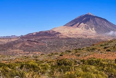
 Spain
SpainSelf-Guided Cycling Holiday
Length: 8 Days
Level: 
Price: from €1,490 EUR
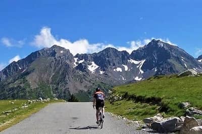
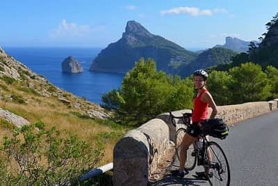 Spain
SpainSelf-Guided Cycling Holiday
Length: 7 Days
Level: 
Price: from €1,420 EUR
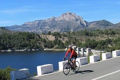 Spain
SpainSelf-Guided Cycling Holiday
Length: 7 Days
Level:
Price: from €1,470 EUR
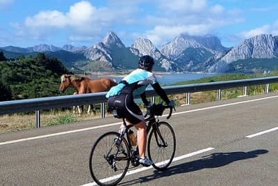
 France
Self-Guided Cycling Holiday
Length: 8 Days
Level:
Price: from €1,070 EUR